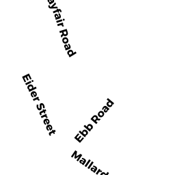
290 MAYFAIR ROAD SD
Owner Information
FLAVIN DANIEL C
290 MAYFAIR ROAD
SOUTH DENNIS, MA 02660


Property Details
290 MAYFAIR ROAD SD is classified as a Single Family Residential (Ranch).
The primary structure on this property was built in 1959. There are 840ft2 of built area within this property. There is 840ft2 of residential/living space within this property. This property is listed as having 5 rooms.
290 MAYFAIR ROAD SD is valued at $250,300. The land is valued at $113,800 and the structures are valued at $136,500.
The most recent deed for 290 MAYFAIR ROAD SD is recorded at the local registrar in Book 30518, Page 30. 290 MAYFAIR ROAD SD was last sold on Tuesday, May 30, 2017 for $242,900.
Assessment data from fiscal year 2022.
Flood Data
According to the FEMA National Flood Hazard Layer, this property does not appear to be in a flood zone. It may also be in an area not yet reviewed. Nonetheless, confirm this information prior to taking any action.
To view the flood hazards around this property, create a FEMA "Firmette" Map of the area around 290 MAYFAIR ROAD SD.
Broadband Internet Providers
| Provider | Type | Bandwidth (mbps) | |
|---|---|---|---|
| Viasat Inc | Satellite | 35 | 3 |
| T-Mobile | Fixed Wireless | 25 | 3 |
| Comcast | Cable | 1000 | 35 |
| GCI Communication Corp. | Satellite | 0 | 0 |
| HughesNet | Satellite | 25 | 3 |
| Verizon New England Inc. | DSL | 5 | 0 |
| VSAT Systems, LLC. | Satellite | 2 | 1 |
Broadband service provider data from December 2020.
Adjacent Properties
- 28 BAY RIDGE DRIVE SD
Single Family Residential owned by ANDERSON JEAN M TRUSTEE - 286 MAYFAIR ROAD SD
Single Family Residential owned by MAHRDT MARGARET - 32 BAY RIDGE DRIVE SD
Single Family Residential owned by BERNARD MAUREEN ET AL - 38 BAY RIDGE DRIVE SD
Single Family Residential owned by PAQUIN MARK P - 296 MAYFAIR ROAD SD
Single Family Residential owned by WURSTER SCOTT H